Counter-UAS | Monitoring Lower Airspace
- Customer
Public Sector
- Partner
Robin Radar | Axis
- Environment
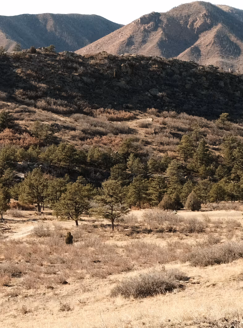
Critical Infrastructure
- LAbel
CUAS
- Year
2026

The Challenge:
The lower airspace is becoming increasingly crowded. Drones are now used for logistics, inspections, mapping, research, and testing, while private and recreational drone use is also increasing.
At Berlin TXL, the situation is particularly complex. In addition to commercial and recreational drone activity, the same airspace is used by the German Armed Forces, police, and rescue aviation. At the same time, unauthorized drone flights are becoming more common — creating risks for aviation safety, critical infrastructure, and industrial security.
Today, drone flights are not sufficiently integrated into existing airspace registration systems. Registered flights, unauthorized drones, no-flight-zone violations, and potential conflicts with other airspace users are difficult to detect and assess in real time.
Berlin TXL therefore needs a capability to monitor, verify, and coordinate lower-airspace activity as drone traffic increases.
The Approach:
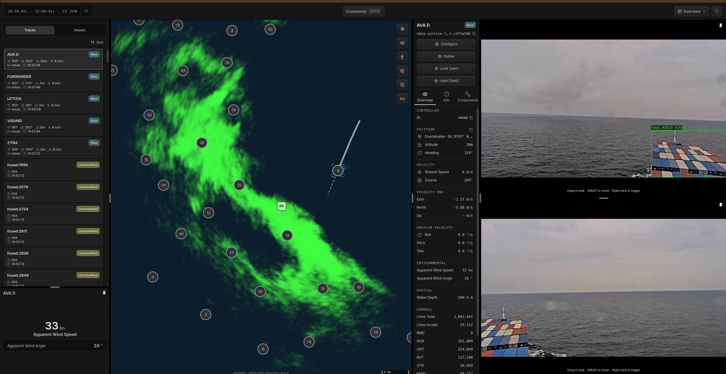
Project Q connects acoustic, electro-optical, and radar systems through Hydris to create a single operational picture of the lower airspace. Hydris fuses the sensor data, triggers user-defined alerts, and links the detection with drone flight registration software.
The Setup:
A multimodal sensor setup detects and tracks airborne objects in the lower airspace. Q’s UGS acoustic capability provides early warning and classification, cueing the radar for precise localization and tracking. Radar-initiated camera tracking enables visual confirmation of flying objects.
Hydris acts as an integration and orchestration layer, compiling all sensor data into a single operational picture. It provides user-defined alarms and integrates with existing drone flight registration software.
The Outcome
Every drone in the lower airspace is continuously tracked. Operators can distinguish between registered and unauthorized flights, while no-fly-zone violations are detected and linked to the identified drone and its pilot.
More information: Tegel Projekt Steckbrief Monitoring Lower Airspace
- Q-Box
Running Hydris v0.9 — sensor fusion and rule execution at the edge.
- Q-Seismic × 8
Ground vibration sensors covering the perimeter boundary.
By combining the existing drone flight registration systems with an innovative detection system and data-driven analysis, a reliable representation of all flight movements is enabled — for greater safety, transparency, and efficiency.
- Multi-sensor detection — radar, optical, and acoustic sensors fused into a single operational picture
- Registered vs unauthorized — every track checked against the existing booking record
- No-fly-zone alerts — breaches flagged and tied to the drone and its operator
Other Missions served.

- Sense-to-Warn
- 2026
Legacy Sensor Integration | CBRN reconnaissance
Lorem ipsum dolor sit amet, consectetur adipiscing elit. Suspendisse varius enim in eros elementum tristique. Duis cursus, mi quis viverra ornare, eros dolor interdum nulla, ut commodo diam libero vitae erat. Aenean faucibus nibh et justo cursus id rutrum lorem imperdiet. Nunc ut sem vitae risus tristique posuere.
Heading 1
Heading 2
Heading 3
Heading 4
Heading 5
Heading 6
Lorem ipsum dolor sit amet, consectetur adipiscing elit, sed do eiusmod tempor incididunt ut labore et dolore magna aliqua. Ut enim ad minim veniam, quis nostrud exercitation ullamco laboris nisi ut aliquip ex ea commodo consequat. Duis aute irure dolor in reprehenderit in voluptate velit esse cillum dolore eu fugiat nulla pariatur.
Block quote
Ordered list
- Item 1
- Item 2
- Item 3
Unordered list
- Item A
- Item B
- Item C
Bold text
Emphasis
Superscript
Subscript
- Track-to-Avoid
- 2026
Maritime Domain Awareness | Collision avoidance
Lorem ipsum dolor sit amet, consectetur adipiscing elit. Suspendisse varius enim in eros elementum tristique. Duis cursus, mi quis viverra ornare, eros dolor interdum nulla, ut commodo diam libero vitae erat. Aenean faucibus nibh et justo cursus id rutrum lorem imperdiet. Nunc ut sem vitae risus tristique posuere.
Heading 1
Heading 2
Heading 3
Heading 4
Heading 5
Heading 6
Lorem ipsum dolor sit amet, consectetur adipiscing elit, sed do eiusmod tempor incididunt ut labore et dolore magna aliqua. Ut enim ad minim veniam, quis nostrud exercitation ullamco laboris nisi ut aliquip ex ea commodo consequat. Duis aute irure dolor in reprehenderit in voluptate velit esse cillum dolore eu fugiat nulla pariatur.
Block quote
Ordered list
- Item 1
- Item 2
- Item 3
Unordered list
- Item A
- Item B
- Item C
Bold text
Emphasis
Superscript
Subscript